 Kenyon Family
Search
Looking for something in particular? Search for it here.
Looking for something in particular? Search for it here.
Fully aware of the risks, Ezra T. Kenyon brought his wife Susan and sons Ezra W. and Dennis to Mount Hope in 1840.
The Mount Hope Colony was another speculative land venture started in 1835 by Yankee investors. The Colony ultimately failed.
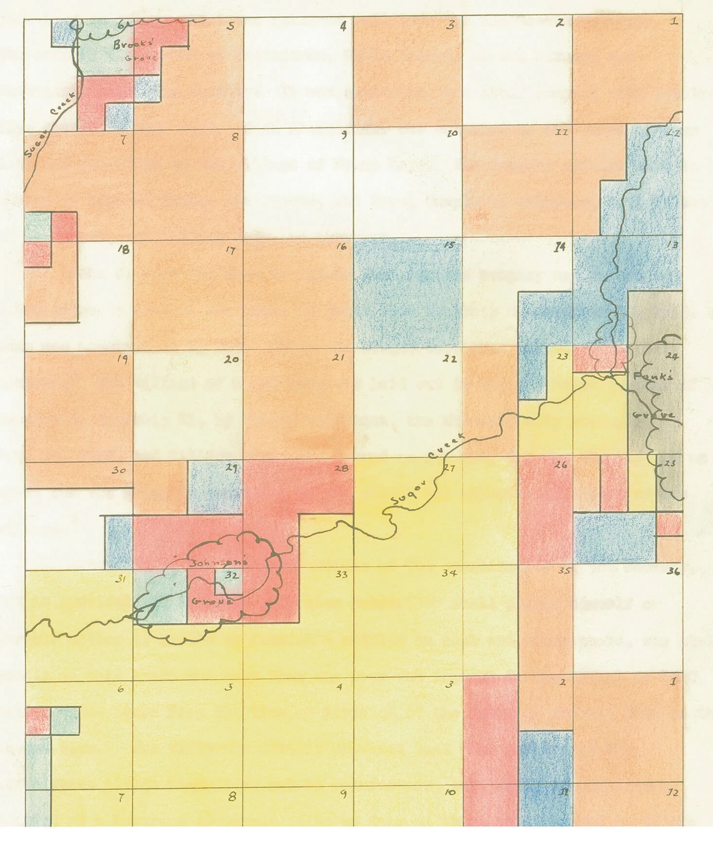
Charted by a group of eastern investors, the Providence Farmers and Mechanics Emigrating Society of Rhode Island purchased 8,580 acres southwest of what is now the town of McLean.
“No Yankee is ever satisfied with his condition... The great hunger of the Anglo-Saxon is land, land, more l and. But the Stoney, Sandy, Soil of Rhode Is land and Providence Plantation could hardly satisfy this hunger.”
— David McFarland, On Leaving Rhode Island.

Divided into 25 shares, each investor paid $500 for 320 acres (about $1.56 per acre) of farmland and four lots in the village to be named Mount Hope.
Ezra gave up a job as a foreman at a Connecticut cotton mill in order to see the western country he had heard so much about.
The Kenyons set off from Plainfield, Connecticut in April, traveling first to Albany, New York, then by the Erie Canal to Buffalo and by steamer through the Great Lakes to Chicago. They purchased a yoke of oxen and a wagon in Indiana, arriving in Mount Hope nine days later.
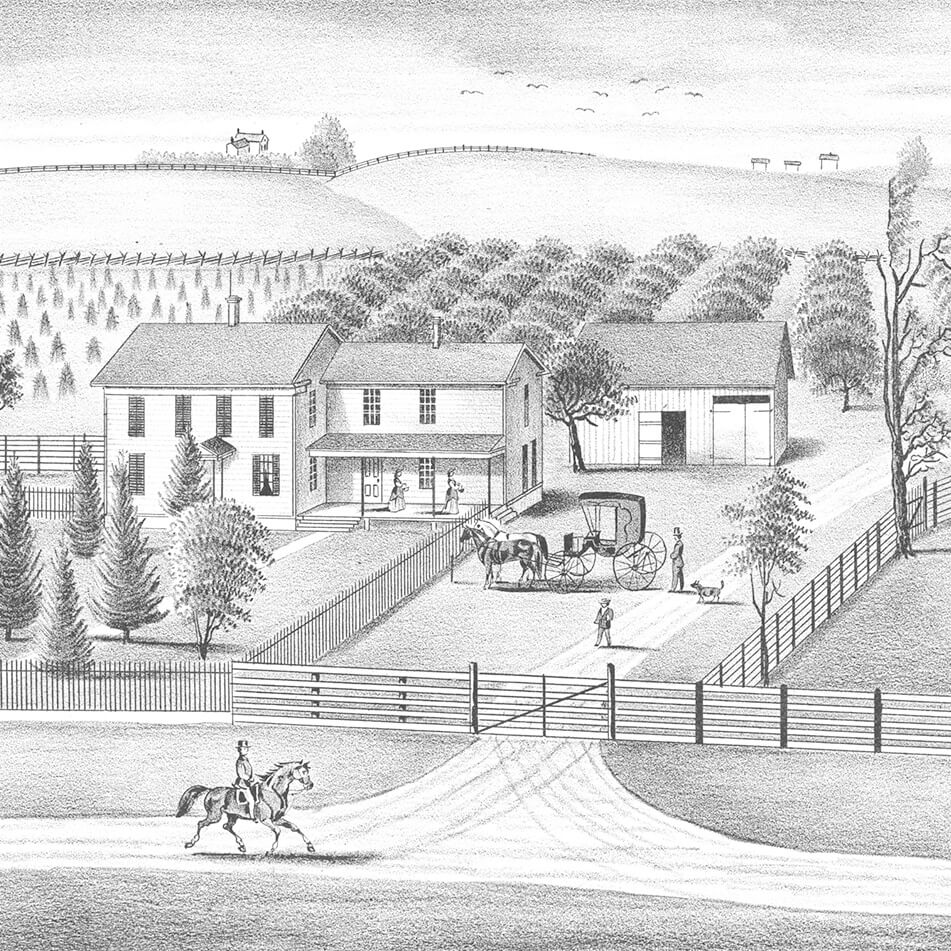
The Kenyons built a home; the first of many improvements to their 160 acre half share of the colony.
The Kenyons were very successful, as were others who invested in and worked the land of Mount Hope. They cleared land a little at a time, and purchased shares from those who could not make a go at working the land. The family eventually owned 400 acres.

Following in the Yankee tradition, both Kenyon boys attended a Mount Hope subscription school to get their education.
Subscription schools, like the one Ezra and Dennis Kenyon attended in Mount Hope, were funded by a monthly tuition fee paid by the parents to the teacher.
Textbooks, like McGuffey readers, were first published in 1836, but not widely used until the 1850s. The Kenyon boys most likely learned to read using newspapers, Shakespeare, or the Bible.
By 1874 Ezra T. Kenyon had passed the original farmstead on to his oldest son and Dennis Kenyon had his own farmstead.
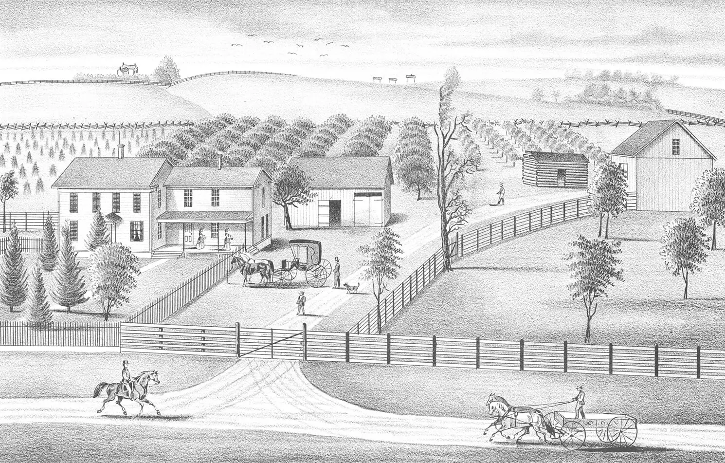
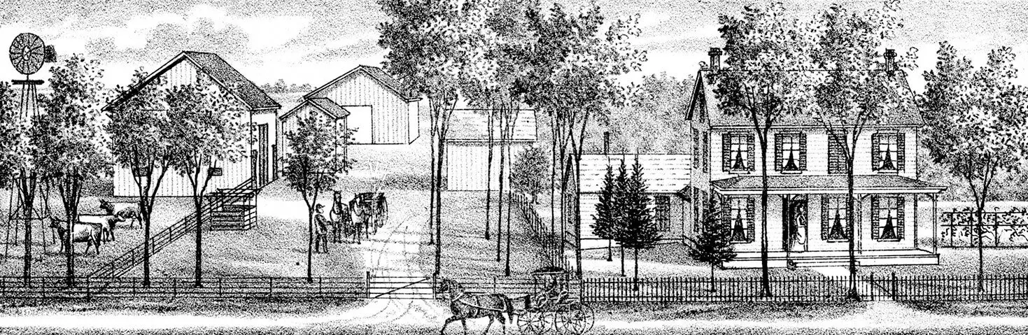
Many improvements had been made to the farm by the 1870s, including an addition to the home and the planting of fruit and shade trees. The log structure on the right side of the image may be the original house, constructed in 1840.
Ezra Kenyon homestead lithograph, 1887
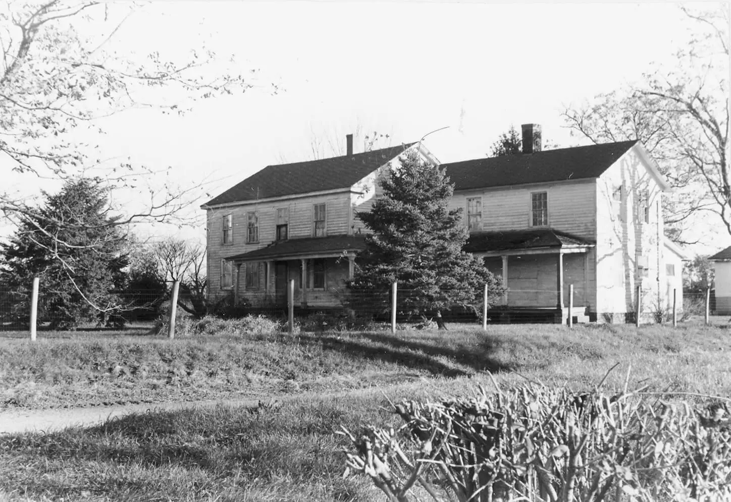
Descendants of the Kenyons still own the farm in Mount Hope township, but they no longer live there and farm it themselves. The farmhouse was still standing in the 1950s, but is now gone.

When the Chicago & Alton Railroad bypassed the village of Mount Hope in 1852, the end loomed.
Most residents and businesses of the Mount Hope village moved to the nearby town of McLean where the Chicago & Alton passed through.
By 1854 the village of Mount Hope was gone.
“The town, with its streets and alleys and public square, was duly mapped out, a stone being planted at the northwest corner of the public square, from which it was decreed that all future surveys should be made. Alas for all human calculations! The stone is about all that is now left of the once prospective city.”
— History Of McLean County, 1879
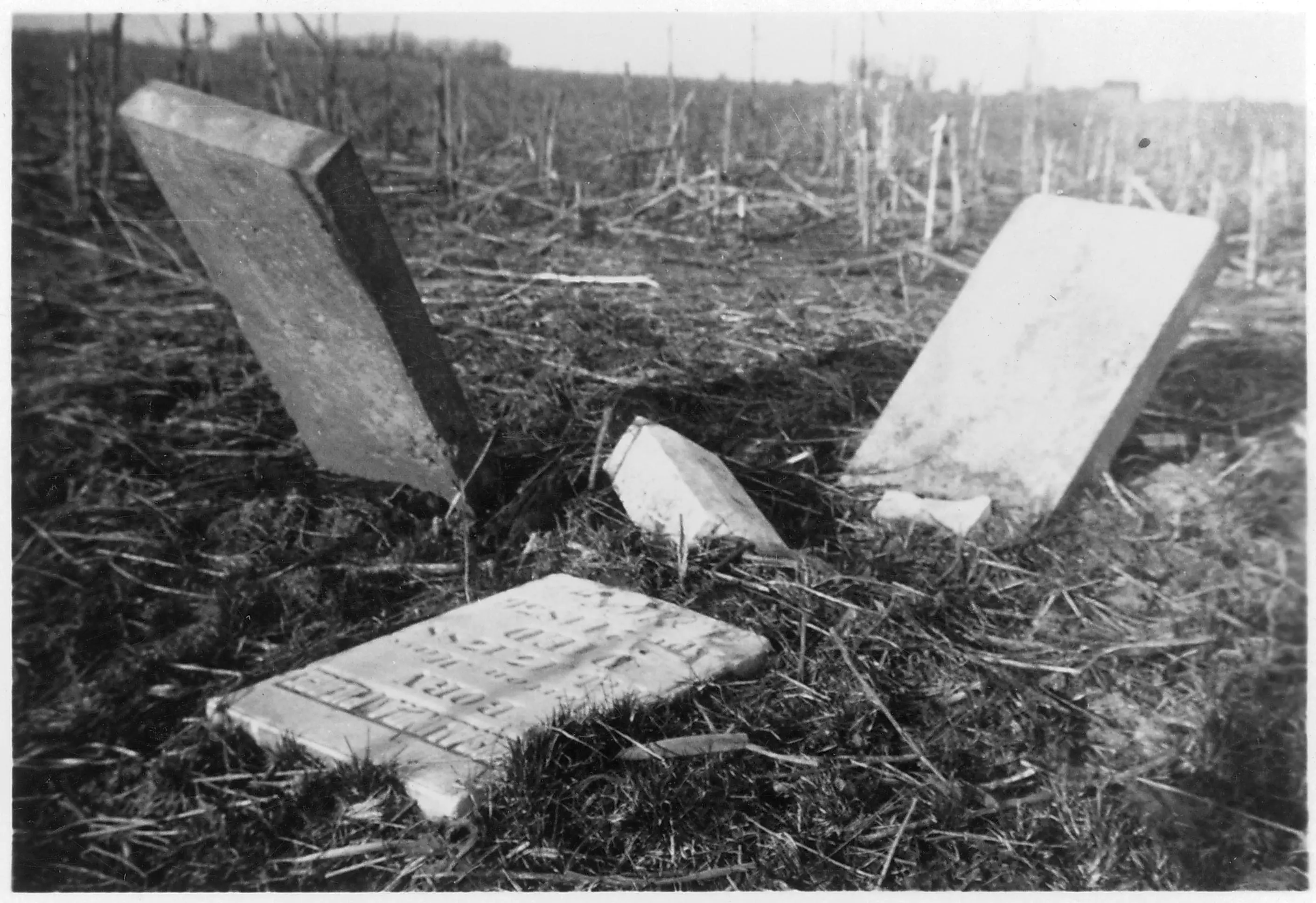
Abandoned homes and businesses represented what could have been for many years. Now all that remains of the village is its cemetery.
